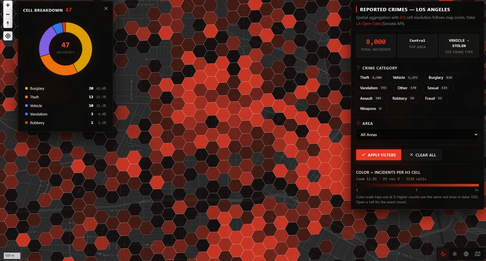
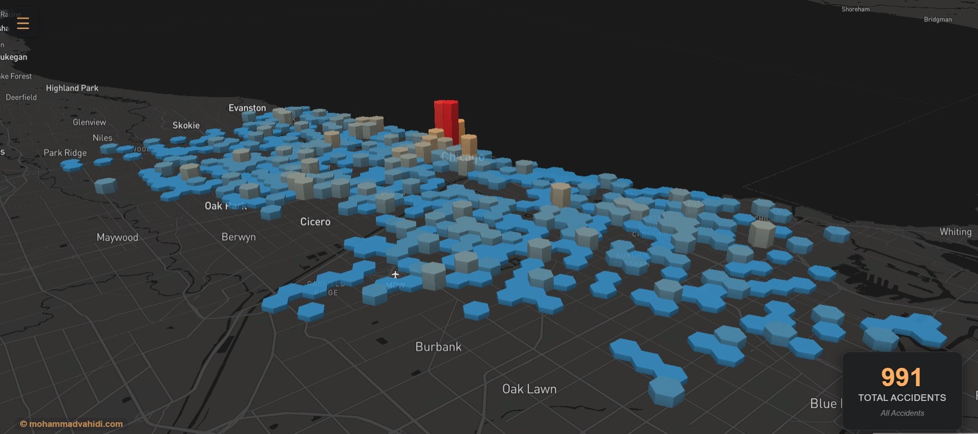
Hi, I'm Mohammad —

MSc Urban Planning Student, Shahid Beheshti University

Freelance Specialist in Urban Planning, GIS Analysis, and Smart City Projects

GIS Analyst & WebGIS Developer

Urban Innovation Researcher, Mammute Urban Innovation Studio (MUIS)

About me

MSc Urban Planning student with a focus on innovative, tech-driven solutions for urban challenges. Currently specializing in Spatial Analysis, geospatial technologies, Web GIS design and smart city implementation. Experienced in urban innovation and regional planning, with an interest in data analysis and programming. Passionate about enhancing the built environment.

Blog

Portfolio

3d-webgis
comprehensive React-based web application that creates an interactive digital twin of urban neighborhood. This project demonstrates the power of modern web technologies in creating immersive, data-driven urban planning tools.
population-webgis2
WebGIS dashboard based on Population and Housing Census data, transforming raw statistics into spatial insights to support urban planning and decision-making.
fmc
Dive into the “15-minute city” concept through this interactive WebGIS platform
image_2024-12-13_01-53-30
This interactive map allows users to explore and download Realtime AQI data.
PP15
This project involved the development of a participatory dashboard connected to a WebGIS platform, enabling users to submit feedback, comments, and reactions to urban planning proposals.
MSHSW1
This interactive WebGIS project showcases the historical layout of Mashhad in the year 1333 (1954) alongside its present-day urban structure.